Comprehensive Underwater Solutions
From routine hull inspections to complex subsea surveys, our drone fleet delivers precision data at any depth.
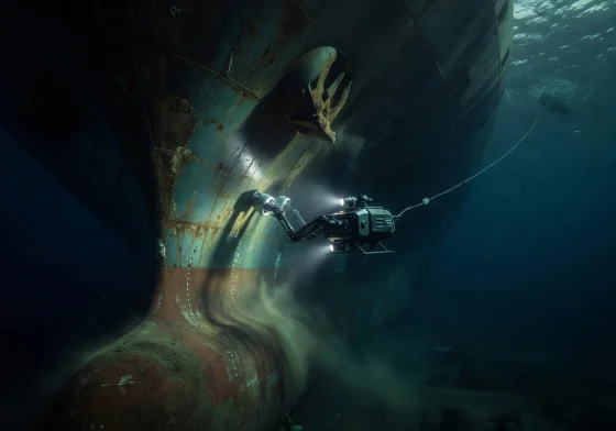
Hull Inspection
Our ROV drones deliver high-resolution visual and ultrasonic hull inspections, identifying corrosion, biofouling, weld defects, and structural anomalies — all without the need for drydocking.
- 4K HDR video and 48MP still capture
- Ultrasonic thickness measurement (UTM)
- Cathodic protection (CP) survey integration
- Real-time streaming to onshore teams
- Class-approved reporting (DNV, Lloyd's, BV)
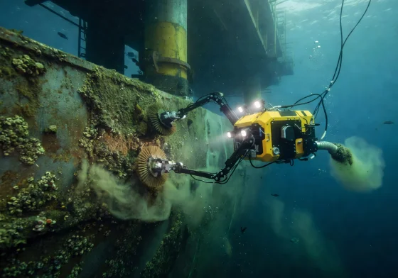
Preventive Maintenance
Proactive underwater maintenance programs that detect and address issues before they become critical failures. Our drones clean, monitor, and document subsea infrastructure on scheduled cycles.
- Cavitation cleaning attachments
- Marine growth removal and documentation
- Anode condition monitoring
- Scheduled inspection programs (quarterly/annual)
- Digital twin integration for asset tracking

Bathymetric Survey
Precision seafloor mapping using multibeam sonar technology. We generate detailed 3D terrain models for construction planning, environmental monitoring, and resource exploration.
- Multibeam echosounder (MBES) profiling
- Sub-centimeter resolution 3D models
- USBL and LBL positioning systems
- IHO S-44 compliant survey data
- GIS-ready deliverables and point clouds
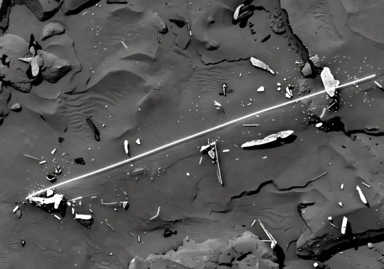
Sonar Mapping
Advanced side-scan and synthetic aperture sonar for object detection, pipeline tracking, and subsea asset documentation — even in zero-visibility conditions.
- Side-scan sonar (SSS) imaging
- Synthetic aperture sonar (SAS) high-resolution
- Sub-bottom profiler for sediment analysis
- Debris field mapping and UXO detection
- Pipeline and cable route surveys
Need a Custom Solution?
Every project is unique. Contact our team to discuss tailored inspection and maintenance packages for your specific requirements.
Get in Touch