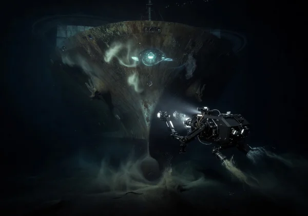
Hull Inspection
High-resolution visual and ultrasonic inspections of vessel hulls, identifying corrosion, biofouling, and structural anomalies without drydocking.
Explore ServiceDeploy advanced ROV drones for hull inspections, infrastructure surveys, and subsea maintenance — with millimeter-level accuracy and real-time data streaming.
From routine inspections to complex subsea operations, our drone fleet delivers precision results at every depth.
High-resolution visual and ultrasonic inspections of vessel hulls, identifying corrosion, biofouling, and structural anomalies without drydocking.
Explore ServiceScheduled underwater maintenance programs using our drone fleet to clean, repair, and monitor subsea infrastructure before issues escalate.
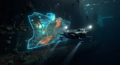
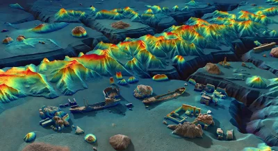
Explore ServicePrecision seafloor mapping and bathymetric profiling using multibeam sonar technology, generating detailed 3D terrain models.
Explore ServiceAdvanced side-scan and synthetic aperture sonar for object detection, pipeline tracking, and subsea asset documentation in any visibility.
Explore ServicePurpose-built ROVs engineered for the most demanding underwater environments.
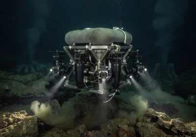
Our flagship ROV with 8-thruster vectored propulsion, 4K HDR cameras, and integrated multibeam sonar.
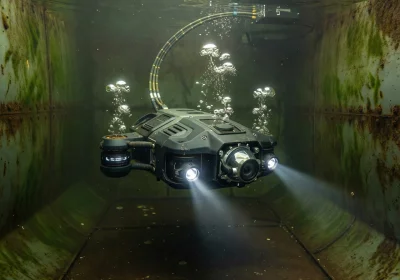
Compact, maneuverable drone designed for confined spaces — ballast tanks, pipelines, and port structures.
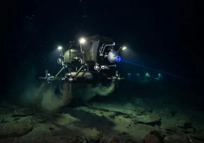
High-endurance survey platform with synthetic aperture sonar, USBL positioning, and 72-hour deployment capability.
Explore how our underwater drone technology has transformed inspection and maintenance operations worldwide.
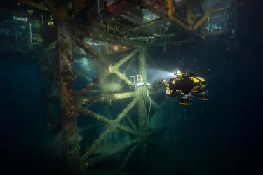
Complete subsea inspection of a 40-year-old oil platform, identifying critical corrosion points and saving $2.3M in potential drydock costs.
Read Case Study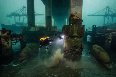
Comprehensive sonar and visual mapping of 186 bridge pilings, providing engineers with 3D models for structural reinforcement planning.
Read Case Study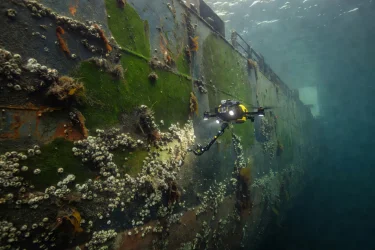
In-water hull inspection of a Very Large Crude Carrier, mapping biofouling density to optimize cleaning and reduce fuel consumption by 12%.
Read Case Study"tulinexira.ink's drone inspection saved us from a catastrophic hull failure. Their precision data identified micro-fractures our traditional divers missed entirely. Exceptional technology and team."

"The 3D sonar maps they delivered were extraordinary. We used them to plan our entire offshore wind farm installation — reducing survey costs by 60% compared to traditional methods."

"Their ROVs inspected our entire dam infrastructure in 5 days — work that would have taken our dive team 3 months. The image clarity at depth was unlike anything we've seen before."

Stay informed with the latest in underwater drone technology, marine safety, and inspection best practices.
Machine learning algorithms are enabling our drones to detect defects in real-time, reducing analysis time by 80%.

Why leading maritime organizations are transitioning to drone-first inspection protocols for hazardous environments.
Understanding multibeam, side-scan, and synthetic aperture sonar technologies for subsea exploration.